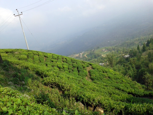
Faits sur Irautar
| Région | 29.3 km² |
| Population | 4 285 |
| Population masculine | 2 075 (48.4%) |
| Population féminine | 2 210 (51.6%) |
| Variation de la population (1975 to 2020) | +896.5% |
| Variation de la population (2000 to 2020) | +0.4% |
| Age moyen | 23.9 ans (Hommes : 24.2, Femmes : 23.7) |
| Heure locale | |
| Fuseau horaire | heure du Népal |
| Lat. et long. | 26.79516, 88.09790 |
Carte de Irautar
Carte interactive
Population de Irautar
Années 1975 à 2020
| Data | 1975 | 1990 | 2000 | 2015 | 2020 |
|---|---|---|---|---|---|
| Population | 430 | 2 569 | 4 270 | 3 912 | 4 285 |
| Densité de population | 14,7 / km² | 87,8 / km² | 146 / km² | 133,7 / km² | 146,5 / km² |
Sources: JRC (European Commission's Joint Research Centre) travailler sur GHS built-up grid
Variation de la population de Irautar de 2000 à 2015
Diminution de 8.4% de l'année 2000 à 2015
| Lieu | Variation depuis 1975 | Variation depuis 1990 | Variation depuis 2000 |
|---|---|---|---|
| Irautar | +809.8% | +52.3% | -8.4% |
| Népal | +115.2% | +52.2% | +20.2% |
Sources: JRC (European Commission's Joint Research Centre) travailler sur GHS built-up grid
Âge médian de Irautar
Âge médian : 23.9 ans
| Lieu | Age moyen | Âge médian (femme) | Âge médian (masculin) |
|---|---|---|---|
| Irautar | 23.9 yrs | 23.7 yrs | 24.2 yrs |
| Népal | 21.7 yrs | 22.6 yrs | 20.4 yrs |
Sources: CIESIN (Center for International Earth Science Information Network)
Densité de population de Irautar
Densité de population : 147 / km²
| Lieu | Population | Région | Densité |
|---|---|---|---|
| Irautar | 4 285 | 29,3 km² | 147 / km² |
| Népal | 28,7 million | 147 926,4 km² | 194 / km² |
Sources: JRC (European Commission's Joint Research Centre) travailler sur GHS built-up grid
Population historique et projetée de Irautar
Population estimée de 1700 à 2100
Sources:
- JRC (European Commission's Joint Research Centre) travailler sur GHS built-up grid
- CIESIN (Center for International Earth Science Information Network)
- [Lien] Klein Goldewijk, K., Beusen, A., Doelman, J., and Stehfest, E.: Anthropogenic land use estimates for the Holocene – HYDE 3.2, Earth Syst. Sci. Data, 9, 927–953, https://doi.org/10.5194/essd-9-927-2017, 2017.
Indice de développement humain (IDH)
Indice composite statistique de l'espérance de vie, de l'éducation et du revenu par habitant.
Source: [Lien] Kummu, M., Taka, M. &Guillaume, J. Ensembles de données mondiales en grille pour le Produit Intérieur Brut et l'Indice de Développement Humain sur 1990–2015. Sci Data 5, 180004 (2018) doi:10.1038/sdata.2018.4
Émissions de CO2 de Irautar
Émissions de dioxyde de carbone (CO2) par habitant en tonnes par an
| Lieu | Emissions de CO2 | Émissions de CO2 par habitant | Intensité des émissions de CO2 |
|---|---|---|---|
| Irautar | 1,442 tn | 0.34 tn | 49.3 tons/km² |
| Népal | 11,136,221 tn | 0.39 tn | 75.3 tons/km² |
Sources: [Lien] Moran, D., Kanemoto K; Jiborn, M., Wood, R., Többen, J., and Seto, K.C. (2018) Empreintes carbone de 13 000 villes. Environmental Research Letters DOI: 10.1088/1748-9326/aac72a
Émissions de CO2 de Irautar
| Émissions de CO2 en 2013 (tonnes/an) | 1,442 tn |
| Émissions de CO2 en 2013 (tonnes/an) par habitant | 0.34 tn |
| Intensité des émissions de CO2 en 2013 (tonnes/km²/an) | 49.3 tons/km² |
Risque de dangers naturels
Relative risk out of 10
| Danger | Risk Level |
|---|---|
| Drought | Medium (5) |
| Flood | High (10) |
| Earthquake | Medium (5.9) |
| Landslide | High (8) |
* Risk, particularly concerning flood or landslide, may not be for the entire area.
Sources:
- Dilley, M., R.S. Chen, U. Deichmann, A.L. Lerner-Lam, M. Arnold, J. Agwe, P. Buys, O. Kjekstad, B. Lyon, and G. Yetman. 2005. Natural Disaster Hotspots: A Global Risk Analysis. Washington, D.C.: World Bank. https://doi.org/10.1596/0-8213-5930-4.
- Center for Hazards and Risk Research - CHRR - Columbia University, Center for International Earth Science Information Network - CIESIN - Columbia University, and Norwegian Geotechnical Institute - NGI. 2005. Global Landslide Hazard Distribution. Palisades, NY: NASA Socioeconomic Data and Applications Center (SEDAC). https://doi.org/10.7927/H4P848VZ.
- Center for Hazards and Risk Research - CHRR - Columbia University, Center for International Earth Science Information Network - CIESIN - Columbia University, and International Research Institute for Climate and Society - IRI - Columbia University. 2005. Global Drought Hazard Frequency and Distribution. Palisades, NY: NASA Socioeconomic Data and Applications Center (SEDAC). https://doi.org/10.7927/H4VX0DFT.
- Center for Hazards and Risk Research - CHRR - Columbia University, Center for International Earth Science Information Network - CIESIN - Columbia University. 2005. Global Flood Hazard Frequency and Distribution. Palisades, NY: NASA Socioeconomic Data and Applications Center (SEDAC). https://doi.org/10.7927/H4668B3D.
- Center for Hazards and Risk Research - CHRR - Columbia University, Center for International Earth Science Information Network - CIESIN - Columbia University. 2005. Global Earthquake Hazard Distribution - Peak Ground Acceleration. Palisades, NY: NASA Socioeconomic Data and Applications Center (SEDAC). https://doi.org/10.7927/H4BZ63ZS.
Tremblements de terre récents à proximité
Magnitude 3.0 et plus
| Date▼ | Heure↕ | Magnitude↕ | Distance↕ | Profondeur↕ | Lieu↕ | Lien |
|---|---|---|---|---|---|---|
| 1/16/19 | 11:56 PM | 3.8 | 85.6 km | 10,000 m | 27km NW of Samtse, Bhutan | usgs.gov |
| 6/20/18 | 4:15 AM | 4.4 | 48.5 km | 52,910 m | 29km NNW of Ilam, Nepal | usgs.gov |
| 6/20/18 | 4:08 AM | 4.4 | 61.8 km | 38,300 m | 17km E of Dhankuta, Nepal | usgs.gov |
| 6/17/18 | 3:07 PM | 4.4 | 78.6 km | 49,760 m | 12km SSW of Mangan, India | usgs.gov |
| 12/2/17 | 11:43 PM | 4.2 | 54.4 km | 10,000 m | 24km NW of Naya Bazar, India | usgs.gov |
| 5/16/17 | 10:13 PM | 4.2 | 59.3 km | 10,000 m | 23km NNW of Naya Bazar, India | usgs.gov |
| 3/26/17 | 9:42 PM | 4.5 | 59.3 km | 24,390 m | 5km SSE of Rangpo, India | usgs.gov |
| 3/12/16 | 4:15 PM | 3.9 | 98.9 km | 14,880 m | 9km NW of Birpara, India | usgs.gov |
| 10/10/15 | 1:48 AM | 4.3 | 86.4 km | 48,220 m | 20km ESE of Gangtok, India | usgs.gov |
| 8/15/15 | 5:42 AM | 4.4 | 68.7 km | 10,000 m | 48km WNW of Naya Bazar, India | usgs.gov |
Source: U.S. Geological Survey (USGS)
À propos de nos données
Les données de cette page sont estimées à l'aide de divers outils et ressources accessibles au public. Elles sont fournies sans garantie et peuvent contenir des inexactitudes. Utilisez-les à vos risques et périls.